Select NOAA-NWS Forecast Office Text Products
(Product availability varies with seasons, forecast office, and weather.)
Forecast Discussion for ,
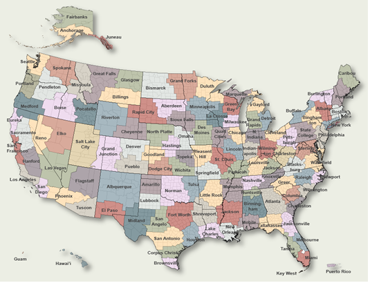
To Select Another NWS Office Click on Map or Choose from List
|
| Select Forecast Office: | Select Product: |
865
FXUS66 KLOX 031323
AFDLOX

Area Forecast Discussion
National Weather Service Los Angeles/Oxnard CA
523 AM PST Mon Mar 3 2025

.SYNOPSIS...03/352 AM.

A cool and brisk weather pattern is on tap for today and tonight.
Temperatures below seasonal averages are forecast through late
this week. Showers will mainly linger over the mountains this
morning, otherwise skies will clear through the day. A stronger
storm system will affect the area Tuesday night through Thursday
and bring periods of moderate rain, mountain snow, and gusty winds
to the region. Another storm is forecast to move over the region
early next week.

&&

.SHORT TERM (TDY-WED)...03/448 AM.

A cold upper-level trough can be seen spinning over the Great
Basin this morning. Showers linger across the northern portions of
the area this morning as a low and middle level northwest flow
continues across the region. Clouds and showers remain banked up
against the northern slopes of the mountains and the winter
weather advisory remains in effect for accumulating snow and gusty
northwest winds. A tight surface pressure gradient remains across
the area this morning and wind advisories have been extended
across the region into tonight. There is a chance that wind
advisories could added for other areas across the Los Angeles
Basin should winds increase to advisory levels again today. The
main concern is for the Interstate 5 Corridor and the western
Antelope Valley foothills as 850 mb winds increase to 45 knots
this morning. EPS wind gust means advertise wind gust means close
to 60 mph this morning. Observations will need to be monitored
closely as the winds may problematic enough to upgrade to a
winter storm warning across the region, and a high wind warning
across the western Antelope Valley foothills.

Otherwise, clearer skies will develop through today and tonight.
The storm should exit the region this evening, and winds should
subside through the night tonight. A cool air mass is expected to
linger though with temperatures remaining about 3-8 degrees below
normal through late week.

The next storm system should begin affecting the northern areas as
early as Tuesday night and the Southland by Wednesday. PoPs have
been increased over NBM values into Wednesday as the latest
forecast ensembles and deterministic solutions suggest a moist
and unstable air mass with a favorable flow pattern for widespread
precipitation across the area. A period of rain and mountain snow
can be expected between Tuesday night and Thursday. A cold air
mass aloft will spread into the region with this storm, and
thunderstorms and low snow levels cannot be ruled out. Rainfall
amounts with the storm look to range between 0.50 to 1.00 inch
across the coast and valleys with up to 1.00 to 3.00 inches in
the mountains. Due to the southerly flow with the system, the
south-facing slopes of the mountains will be in a favorable flow
pattern for orographic lift. The highest amounts will likely be in
the San Gabriel mountain range with the storm. This storm
possesses some ingredients to create heavy rainfall and residents
living near recently burned areas should stay tuned to latest
forecast and monitor up-to-date information from local officials
regarding this storm.

Snow levels could fall to between 3000 and 4000 feet and there is
a high chance that advisory level snowfall will developing. Early
estimates suggest 4 to 8 inches of snow at 5000 feet with amounts
up to 12 to 18 inches at the resort level. Travel on Interstate 5
could be affected by accumulating snowfall on Wednesday night and
Thursday morning.

Gusty winds are likely with the storm system both ahead of the
front in the mountains and desert, and behind the front over most
coastal, mountain, and desert areas.

.LONG TERM (THU-SUN)...03/450 AM.

The system will exit the region on Thursday, but the leave a tight
pressure gradient across the area. Gusty west to northwest winds
are likely on Thursday afternoon and evening. A cold moist
unstable flow will continue into Thursday and favor a showery and
unsettled pattern along the Central Coast, through the Interstate
5 Corridor and along the northern slopes of the mountains and
into the San Gabriel Mountains. Some showers could also affect the
San Gabriel Valley.

A warming and drying trend will establish for Friday and Saturday
as ridging aloft will start to build in across the region.
Temperatures, being on the cool side of normal for much of the
week, could actually reach near normal values on Saturday and
Sunday. Some gusty northerly winds could linger into Friday
morning.

A return to a wet weather still looks to be shaping up for the
second week of March. The forecast ensembles continues to
highlight a cool, wet, and unsettled weather pattern resuming as
two potential storm systems move over the region sometime between
March 9th and March 15th. NWS CPC continues to highlight a well
above normal chance of precipitation during this period.

&&

.AVIATION...03/1319Z.

At 12Z at KLAX, there was no marine layer nor an inversion, but
there was plenty of low and mid level moisture.

Skies were cloudy across most of SLO/SBA Counties and in the
mountains of Ventura and Los Angeles Counties. Conds were mostly
MVFR in coastal and valley areas, and IFR to VLIFR in the mtns and
foothills. There will be scatter rain showers and snow showers
through late morning or early afternoon in the mtns. Skies should
become mostly clear later today, and remain so tonight with
VFR conds expected. The exception could be some patchy fog with
IFR to LIFR vsbys late tonight.

Widespread strong W-NW winds will affect the region into tonight,
with some LLWS and moderate turbulence. There will be moderate
UDDF, especially near the mtns and in the Antelope Vly.

KLAX...High confidence in 12Z TAF with VFR conds expected. There
is a 20% chance of N cross wind gusts to 20 kt 03Z-09Z this eve.
There is a 20% chance of E-NE winds of 8-10 kt 10Z-16Z Tue.

KBUR...High confidence in 12Z TAF with VFR conds expected.

&&

.MARINE...03/519 AM.

GALE force winds will affect the inner waters S of Pt. Conception
(PZZ650/655), and the southern two outer waters zones (PZZ673/676)
into tonight, while Small Craft Advisory (SCA) conds will affect
the northern outer water zone and the inner waters N of Pt Sal.
Winds will decrease in all areas tonight, dropping below SALE
force late tonight, and below SCA levels in most areas by morning.

Large and steep seas today will slowly subside tonight. However,
seas may linger at or above SCA levels into early Tue morning.

Conds will be mostly below SCA levels Tue into Wed morning. A
period of moderate SE-S winds will affect the waters Wed afternoon
into early Wed night. There is a 60% chance winds will reach SCA
levels in the northern two outer waters zones and in the Santa
Barbara Channel, and a 40% chance elsewhere.

SCA level NW winds are likely across the entire waters late Wed
night thru Fri evening, though winds may drop off briefly late
Thu night/Fri morning in the inner waters near the coast.

&&

.BEACHES...03/522 AM.

High surf of 5 to 8 feet with local sets to 9 feet is expected on
west-facing beaches of Ventura and Los Angeles counties thru this
evening, with high surf of 10 to 15 feet on Central Coast beaches.
Minor beach erosion is possible on these beaches as well.

Along the beaches of southern Santa Barbara County, dangerous rip
currents and elevated surf of 3 to 6 feet can be expected through
early this evening, highest on west-facing beaches.

Surf will drop below advisory levels in most areas this evening.

&&

.LOX WATCHES/WARNINGS/ADVISORIES...
CA...Wind Advisory now in effect until 9 PM PST this evening for
      zones 340-341-346>348-354-355-362. (See LAXNPWLOX).
     High Surf Advisory in effect until 9 PM PST this evening for
      zones 340-346-354-362-366. (See LAXCFWLOX).
     Wind Advisory now in effect until 3 AM PST Tuesday for zones
      349>352-356. (See LAXNPWLOX).
     Beach Hazards Statement in effect through this evening for
      zones 349-350. (See LAXCFWLOX).
     Wind Advisory remains in effect until 3 AM PST Tuesday for
      zones 376-381>383. (See LAXNPWLOX).
     Winter Weather Advisory remains in effect until 4 PM PST this
      afternoon for zones 377-378. (See LAXWSWLOX).
     Winter Weather Advisory remains in effect until 6 AM PST
      early this morning for zones 379-380. (See LAXWSWLOX).
PZ...Small Craft Advisory in effect until 3 AM PST Tuesday for
      zones 645-670. (See LAXMWWLOX).
     Gale Warning in effect until 3 AM PST Tuesday for zones
      650-655-673-676. (See LAXMWWLOX).

&&

$$

PUBLIC...Hall
AVIATION...DB
MARINE...DB
BEACHES...DB
SYNOPSIS...Hall

weather.gov/losangeles

Experimental Graphical Hazardous Weather Outlook at:
https://www.weather.gov/erh/ghwo?wfo=lox
|
Previous Forecast Discussions may be found at
NWS , (LOX) Office Forecast Discussions.
(Click 'Previous Version' there to view past versions successively.
Some may differ only in time posted.)
Products Courtesy of NOAA-NWS
NWS Information Parsing Script by Ken True at Saratoga Weather - WFO and Products Scripts by SE Lincoln Weather.
Mapping by Curly at Michiana Weather and by Tom at My Mishawaka Weather.