Select NOAA-NWS Forecast Office Text Products
(Product availability varies with seasons, forecast office, and weather.)
Forecast Discussion for ,
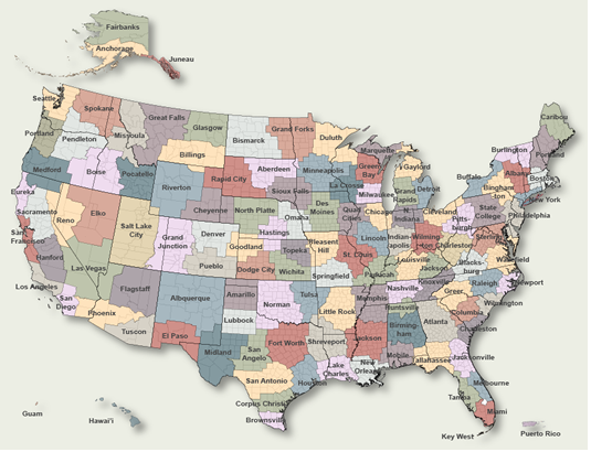
To Select Another NWS Office Click on Map or Choose from List
|
| Select Forecast Office: | Select Product: |
272
FXUS66 KLOX 261739
AFDLOX

Area Forecast Discussion
National Weather Service Los Angeles/Oxnard CA
1039 AM PDT Sun Jul 26 2026

.SYNOPSIS...26/208 AM.

Hotter than normal conditions will continue for the foreseeable
future, generally hottest through Sunday. Slightly cooler Monday
through Thursday, with heat increasing again Friday and Saturday.
The hot daytime and warm night conditions will bring elevated
risks of heat-related illness.

&&

.SHORT TERM (TDY-TUE)...26/204 AM.

An influx of mid-to-upper level moisture is pushing into southern
California from Mexico. This moisture will bring partly to mostly
cloudy conditions at times today to Los Angeles, Ventura, and
Santa Barbara Counties. Any time there is an influx like this, the
chances for some light showers lifts above 0%. The atmosphere is
fairly stable however. There are some mesoscale sources of lift as
some weak disturbances rotate through, but they are light. As a
result, there is a 5-15% chance for some fat-drop light showers
and a remote (0-5%) chance of a mostly dry thunderstorm. These
chances peak in the mountains and deserts this afternoon and
evening. Will continue to monitor for any changes.

Overall, latest models in good synoptic agreement through the
short term period. At upper levels, high pressure centered near
the 4 Corners will slowly wobble eastward through the period. At
the surface, moderate onshore flow will continue to the east with
weak to moderate northwesterly flow at times.

Forecast-wise, main issue in the short term will continue to be
the heat. Highs today topped out in the mid 90s to 104 across the
valleys and interior sections. Given the synoptic pattern, will
expect H5 heights and thicknesses to slowly decrease through
Tuesday. So, Sunday will likely be the warmest day with a bit of
cooling for most areas Monday and Tuesday. With warm overnight low
temperatures, conditions will remain rather uncomfortable. Heat
Risk grids indicate moderate to high heat risk will continue
through Monday. So, current suite of HEAT ADVISORIES, as well as
the EXTREME HEAT WARNING for the Antelope Valley, are looking good
through Monday evening.

Secondary concern for the short term will be winds, specifically
Sundowner winds across southern Santa Barbara county. Based on
high resolution data, northerly offshore pressure gradients peak
Sunday evening and again Monday evening (SBA-SMX gradients
forecast to be -3.7 mb). So, there will be some gusty northerly
winds across the Santa Ynez Range, especially the western half,
and Wind Advisories may be needed, beginning tomorrow.

Given the hot temperatures, as well as low surface humidity and
gusty winds, there will be elevated to potentially brief critical
fire weather conditions across interior sections through the
period. Any grass fires will likely spread very quickly.
Additionally, mixing heights will be quite high. So, there will be
the potential for some significant, plume-dominated, fire behavior
if any fires ignite.

.LONG TERM (WED-SAT)...26/149 AM.

High pressure aloft will continue to dominate through next weekend.
Still expecting the slight drop in temperatures to continue
through Thursday as the core of the high settles over New
Mexico/Texas. The majority of ensemble projections then have the
high strengthening some while sliding back towards California
Friday through Saturday. Temperatures will likely creep back up 3
to 5 degrees overall. Heat Advisories are not out of the question,
but also not a given based on the under performance of the current
heat event. That warming will be focused mainly over the coastal
areas as the onshore pressure gradients will likely change little.

&&

.AVIATION...26/1733Z.

At 16Z at KLAX, the marine layer was 600 ft deep. The top of the
inversion was 2200 ft with a temperature of 30 Celsius.

There is a 5-10 percent chance of a brief shower through 03Z for
LA County TAFs, highest for KPMD and KWJF.

Low confidence in coastal TAFs after 03Z with a 20-50 percent
chance of low MVFR/IFR cigs 03Z-16Z.

High confidence in VFR conditions through at least Monday at KBUR
KVNY KPMD KWJF.

KLAX...40% chance of BKN006-010 09-16Z Monday. High confidence in
any east winds staying under 6 knots.

KBUR...High confidence in VFR.

&&

.MARINE...26/207 AM.

For the outer waters, moderate to high confidence in the current
forecast. Small Craft Advisory (SCA) level winds can be expected
most of the time through Thursday night. Local gale force gusts
will be possible tonight, with periods of gales possible through
the week. SCA level steep and choppy seas are also expected due to
the consistent, moderate to strong winds.

For the inner waters north of Point Sal, generally high
confidence in the current forecast. SCA level wind gusts should
be prevalent much of the time through Wednesday evening followed
by conds dropping below SCA levels for Thursday and Thursday
night. Steep choppy seas are expected much of the time as well.

For the southern inner waters, moderate to high confidence in the
current forecast. The western Santa Barbara Channel will likely
see SCA level wind gusts at times mainly in the afternoon and
evening hours through Tuesday night. Otherwise and elsewhere,
conds will remain below SCA levels through Thursday night.

&&

.LOX WATCHES/WARNINGS/ADVISORIES...
CA...Heat Advisory remains in effect until 8 PM PDT Monday for
      zones 38-88-342>345-348>358-362-366>382-548. (See LAXNPWLOX).
     Beach Hazards Statement in effect through Wednesday afternoon
      for zones 340-346-354-362-366. (See LAXCFWLOX).
     Extreme Heat Warning in effect until 8 PM PDT Monday for zone
      383. (See LAXNPWLOX).
PZ...Small Craft Advisory in effect until 3 AM PDT Tuesday for
      zones 645-670-673-676. (See LAXMWWLOX).
     Small Craft Advisory in effect from 6 PM this evening to 6 AM
      PDT Monday for zone 650. (See LAXMWWLOX).

&&

$$

PUBLIC...CC/RK
AVIATION...RM
MARINE...Sirard/Ciliberti
SYNOPSIS...RK

weather.gov/losangeles

Experimental Graphical Hazardous Weather Outlook at:
https://www.weather.gov/erh/ghwo?wfo=lox
|
Previous Forecast Discussions may be found at
NWS , (LOX) Office Forecast Discussions.
(Click 'Previous Version' there to view past versions successively.
Some may differ only in time posted.)
Products Courtesy of NOAA-NWS
NWS Information Parsing Script by Ken True at Saratoga Weather - WFO and Products Scripts by SE Lincoln Weather.
Mapping by Curly at Michiana Weather and by Tom at My Mishawaka Weather.